
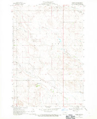
1935 Map of Reva
USGS Topo · Published 1935About this map
Turkey Track Ranch and small settlements like Ludlow and Reva define this 1935 reconnaissance of the Harding County borderlands. The landscape is dominated by the intricate drainages of the Grand River and its numerous forks, including North Fork Grand River and South Fork Sheep Creek. Topographical features such as Lodgepole Buttes, Cedar Butte, and the Flint Hills rise above the plains, providing distinct landmarks for early 20th-century travelers and ranchers.
Find a feature on this map
62 named features on this map. Tap any name to fly to it.
Don’t see what you’re looking for? This feature index may not catch every label — zoom into the map to look around manually.
Map Details
Editions of this 1935 Reva Map
This is the sole edition of this map. No revisions or reprints were ever made.
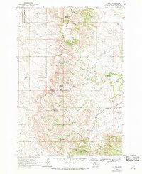
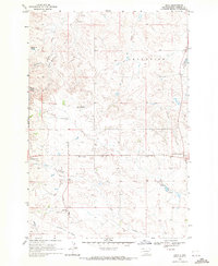
Other maps of this area

1935 · Hoover
USGS Topo · 1:125,000

1935 · Harding
USGS Topo · 1:125,000

1935 · Buffalo
USGS Topo · 1:125,000

1953 · Dickinson
USGS Topo · 1:250,000

1954 · Lemmon
USGS Topo · 1:250,000

1957 · Dickinson
USGS Topo · 1:250,000

1957 · Lemmon
USGS Topo · 1:250,000
1968 · Bowman SW
USGS Topo · 1:24,000
1968 · J B Hill
USGS Topo · 1:24,000
1968 · Reva
USGS Topo · 1:24,000