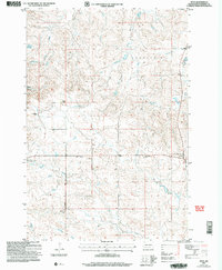
2005 Map of Reva
USGS Topo · Published 2007About this map
The Battle of Slim Buttes marker stands as a central historical point in this portion of Harding County, denoting a significant 1876 engagement between the U.S. Army and the Lakota. The settlement of Reva serves as the local hub, supported by the Reva Sch and nearby spiritual centers like Slim Buttes Ch and Our Lady of the Prairie Ch. The landscape is a complex network of ranching and water management, illustrated by the Besler Ranch and G Lermeney Ranch situated near reliable water sources like McPherson Spring and Bar H Spring.
Find a feature on this map
25 named features on this map. Tap any name to fly to it.
Don’t see what you’re looking for? This feature index may not catch every label — zoom into the map to look around manually.
Map Details
Editions of this 2005 Reva Map
This is the sole edition of this map. No revisions or reprints were ever made.
Other maps of this area

1935 · Reva
USGS Topo · 1:125,000

1935 · Hoover
USGS Topo · 1:125,000

1954 · Lemmon
USGS Topo · 1:250,000

1957 · Lemmon
USGS Topo · 1:250,000

1968 · J B Hill
USGS Topo · 1:24,000

1968 · Reva
USGS Topo · 1:24,000

1968 · Flat Top Butte
USGS Topo · 1:24,000

1969 · Battleship Rock
USGS Topo · 1:24,000

1969 · Reva NW
USGS Topo · 1:24,000

1969 · Reva NE
USGS Topo · 1:24,000