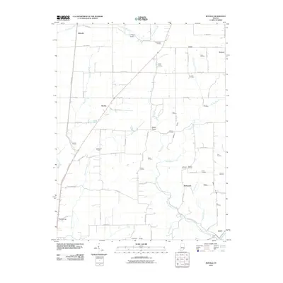
2010 Map of Rexville
USGS Topo · Published 2010About this map
Rexville and Barbersville serve as small crossroads hubs in this rural landscape of southeastern Indiana during the early 21st century. The map reveals a dense distribution of family and community burial grounds, such as Country Farm Cemetery, Hamilton Cemetery, and the Old Westfork Cemetery, which reflect generations of settlement along the waterways. The drainage pattern is dominated by the West Fork Indian Kentucky Creek and Indian Kentucky Creek, which carve through the terrain near Bates Ridge and Hicks Ridge. To the south, the northern boundary of the Jefferson Proving Ground marks a significant transition from farmland to restricted military territory. Researchers will find a preserved network of county roads, like E Bloody Run Rd and E Camp Meeting Rd, which follow the contours of the land and connect historic landmarks like Shelby Church.
Find a feature on this map
83 named features on this map. Tap any name to fly to it.
Don’t see what you’re looking for? This feature index may not catch every label — zoom into the map to look around manually.
Map Details
Editions of this 2010 Rexville Map
This is the sole edition of this map. No revisions or reprints were ever made.
Other maps of this area

1946 · Versailles
USGS Topo · 1:24,000

1946 · Milan
USGS Topo · 1:24,000

1953 · Cincinnati
USGS Topo · 1:250,000

1956 · Clifty Falls
USGS Topo · 1:24,000

1956 · Bennington
USGS Topo · 1:24,000

1956 · Canaan
USGS Topo · 1:24,000

1956 · Louisville
USGS Topo · 1:250,000

1957 · Cincinnati
USGS Topo · 1:250,000

1959 · Holton
USGS Topo · 1:24,000

1959 · San Jacinto
USGS Topo · 1:24,000