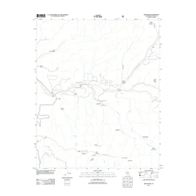
2012 Map of Reyes Peak
USGS Topo · Published 2012About this map
Cuyama River drainage defines this high-elevation landscape in Ventura County, where seasonal waterways like Alamo Cr and Beartrap Cr carve through the steep terrain. The area serves as a significant recreational hub, evidenced by a dense network of mountain camps such as Camp Scheideck and Ozena Campground along Lockwood Valley Rd. Higher elevations are dominated by the massive forms of Pine Mountain and Reyes Peak, where specialized infrastructure including Pine Mountain Campground and Reyes Peak Campground provides access to the summits. The map also captures several vital water sources such as McGuire Spring and Raspberry Spring, which are critical in this arid environment. Traces of industrial access remain visible via the Gypsum Mine Rd, indicating the historical mineral interests that once reached into these remote canyons.
Find a feature on this map
36 named features on this map. Tap any name to fly to it.
Don’t see what you’re looking for? This feature index may not catch every label — zoom into the map to look around manually.
Map Details
Editions of this 2012 Reyes Peak Map
This is the sole edition of this map. No revisions or reprints were ever made.
Other maps of this area

1903 · Mt. Pinos
USGS Topo · 1:125,000

1942 · Wheeler Springs
USGS Topo · 1:24,000

1943 · Rancho Nuevo Creek
USGS Topo · 1:24,000

1943 · Old Man Mountain
USGS Topo · 1:24,000

1943 · Apache Canyon
USGS Topo · 1:24,000

1943 · San Guillermo
USGS Topo · 1:24,000

1943 · Sawmill Mountain
USGS Topo · 1:24,000

1943 · Cuyama Peak
USGS Topo · 1:24,000

1943 · Lion Canyon
USGS Topo · 1:24,000

1943 · Reyes Peak
USGS Topo · 1:24,000