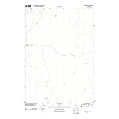
2010 Map of Reynolds
USGS Topo · Published 2010About this map
Reynolds sits at the junction of high-desert drainages in Owyhee County, where the historic Reynolds Creek Stage Rd and Upper Reynolds Creek Rd converge. This 2010 topographic record illustrates a landscape defined by its hydrography, with numerous seasonal and perennial flows such as Scorpion Creek, Rabbit Creek, and Dryden Creek cutting through the terrain. The presence of the Reynolds Creek Stage Rd suggests the enduring importance of this corridor for travel through the Owyhee highlands.
Find a feature on this map
15 named features on this map. Tap any name to fly to it.
Don’t see what you’re looking for? This feature index may not catch every label — zoom into the map to look around manually.
Map Details
Editions of this 2010 Reynolds Map
This is the sole edition of this map. No revisions or reprints were ever made.
Other maps of this area

1892 · Silver City
USGS Topo · 1:125,000

1894 · Silver City
USGS Topo · 1:125,000

1898 · Silver City
USGS Topo · 1:125,000

1955 · Boise
USGS Topo · 1:250,000
1957 · Walters Butte
USGS Topo · 1:24,000

1957 · Wilson Peak
USGS Topo · 1:24,000

1957 · Sands Basin
USGS Topo · 1:62,500

1958 · Boise
USGS Topo · 1:250,000

1962 · Boise
USGS Topo · 1:250,000

1965 · Rooster Comb Peak
USGS Topo · 1:62,500