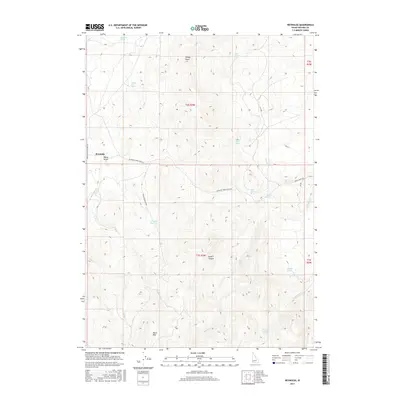
2017 Map of Reynolds
USGS Topo · Published 2017About this map
Reynolds sits at the western edge of this Owyhee County landscape, where the Reynolds Creek Stage Rd and Upper Reynolds Creek Rd meet near Nancy Gulch. This high-desert terrain is defined by a complex network of intermittent water sources and drainages, including the prominent Dryden Reservoir and numerous named springs such as Kane Spring, Griffith Spring, and Ryegrass Spring. The topography rises toward the south and west, reaching distinct heights at Black Mtn and Windy Point.
Find a feature on this map
31 named features on this map. Tap any name to fly to it.
Don’t see what you’re looking for? This feature index may not catch every label — zoom into the map to look around manually.
Map Details
Editions of this 2017 Reynolds Map
This is the sole edition of this map. No revisions or reprints were ever made.
Other maps of this area

1892 · Silver City
USGS Topo · 1:125,000

1894 · Silver City
USGS Topo · 1:125,000

1898 · Silver City
USGS Topo · 1:125,000

1955 · Boise
USGS Topo · 1:250,000
1957 · Walters Butte
USGS Topo · 1:24,000

1957 · Wilson Peak
USGS Topo · 1:24,000

1957 · Sands Basin
USGS Topo · 1:62,500

1958 · Boise
USGS Topo · 1:250,000

1962 · Boise
USGS Topo · 1:250,000

1965 · Rooster Comb Peak
USGS Topo · 1:62,500