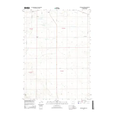
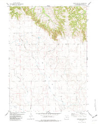
2015 Map of Reynolds Spring
USGS Topo · Published 2015About this map
Lusk sits at the northern edge of this high-plains landscape, where the Niobrara River cuts across the northeastern corner. The area is defined by a series of drainages and springs that feed into the larger river system, most notably Silver Springs Cr and the N Br Silver Springs Cr. For those researching local families, the Reynolds Cem near Reynolds Spring serves as a critical point of interest. The map detail reflects the rural infrastructure of Niobrara County, showing a network of ranch and access roads such as Hoblit Rd and Quigley Rd. Water management is evident through features like Hoblit Reservoir, while the southern terrain shifts into the more distinct topography of Bear Canyon and the wide drainage of Page Flat Draw.
Find a feature on this map
21 named features on this map. Tap any name to fly to it.
Don’t see what you’re looking for? This feature index may not catch every label — zoom into the map to look around manually.
Map Details
Editions of this 2015 Reynolds Spring Map
This is the sole edition of this map. No revisions or reprints were ever made.
Other maps of this area

1954 · Torrington
USGS Topo · 1:250,000

1958 · Torrington
USGS Topo · 1:250,000

1974 · Silver Springs
USGS Topo · 1:24,000

1974 · Rawhide Buttes East
USGS Topo · 1:24,000
1974 · Reynolds Spring
USGS Topo · 1:24,000

1977 · Hileman Draw
USGS Topo · 1:24,000
1978 · Node
USGS Topo · 1:24,000
1978 · Rawhide Buttes West
USGS Topo · 1:24,000

1981 · Lusk
USGS Topo · 1:24,000
1981 · Signature Rock
USGS Topo · 1:24,000