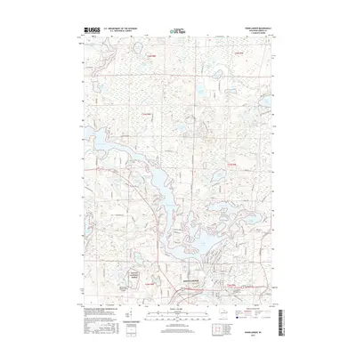
2015 Map of Rhinelander
USGS Topo · Published 2015About this map
Rhinelander serves as the focal point of this northern Wisconsin landscape, where the waters of the Wisconsin River are captured in the expansive Boom Lake and Rhinelander Flowage. The map illustrates a region defined by its glacial hydrology, featuring a dense network of smaller bodies like Mudhen Lake, Crystal Lake, and Silverbass Lake. The transition from the city's residential streets to the protected woodlands of the Nicolet National Forest is clear, showing the intersection of local industry and conservation. Cultural landmarks including the Forest Home Cem and the Rhinelander-Oneida County Airport provide specific points of interest for local history researchers. Along the northern reaches, features like Frederick Flowage and the oddly named The Wart standout among the numerous creeks and marshes that drain this corner of Oneida County.
Find a feature on this map
157 named features on this map. Tap any name to fly to it.
Don’t see what you’re looking for? This feature index may not catch every label — zoom into the map to look around manually.
Map Details
Editions of this 2015 Rhinelander Map
This is the sole edition of this map. No revisions or reprints were ever made.
Other maps of this area

1930 · Robbins
USGS Topo · 1:48,000

1938 · Minocqua
USGS Topo · 1:48,000

1938 · Robbins
USGS Topo · 1:48,000

1939 · Cassian
USGS Topo · 1:48,000

1940 · Rhinelander
USGS Topo · 1:48,000

1942 · Cassian
USGS Topo · 1:48,000

1945 · Robbins
USGS Topo · 1:48,000

1946 · Minocqua
USGS Topo · 1:48,000

1949 · Rhinelander
USGS Topo · 1:48,000

1949 · Minocqua
USGS Topo · 1:48,000