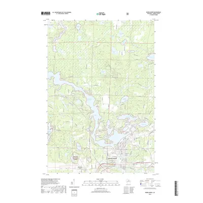
2018 Map of Rhinelander
USGS Topo · Published 2018About this map
Rhinelander sits at the heart of this Northwoods landscape, where the Wisconsin River widens into the Rhinelander Flowage and the expansive Boom Lake. This 2018 survey illustrates a city deeply integrated with its surrounding waterways and timberlands, bordering the western edges of the Nicolet National Forest. The map detail shows the transition from the city's street grid—featuring landmarks like the Rhinelander-Oneida County Airport and Forest Home Cem—to a mosaic of smaller lakes including Thunder Lake, Crystal Lake, and Townline Lake. Significant waterfront development is evident along Mohawk Shores Rd and near the Bertram Lake area, reflecting the region's evolution into a premier recreational and residential hub within Oneida County. The intricate shoreline of South Pine Lake and the various flowages highlight a complex drainage system that has long supported both the local lumber industry and modern tourism.
Find a feature on this map
152 named features on this map. Tap any name to fly to it.
Don’t see what you’re looking for? This feature index may not catch every label — zoom into the map to look around manually.
Map Details
Editions of this 2018 Rhinelander Map
This is the sole edition of this map. No revisions or reprints were ever made.
Other maps of this area

1930 · Robbins
USGS Topo · 1:48,000

1938 · Minocqua
USGS Topo · 1:48,000

1938 · Robbins
USGS Topo · 1:48,000

1939 · Cassian
USGS Topo · 1:48,000

1940 · Rhinelander
USGS Topo · 1:48,000

1942 · Cassian
USGS Topo · 1:48,000

1945 · Robbins
USGS Topo · 1:48,000

1946 · Minocqua
USGS Topo · 1:48,000

1949 · Rhinelander
USGS Topo · 1:48,000

1949 · Minocqua
USGS Topo · 1:48,000