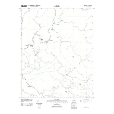
2011 Map of Rhodell
USGS Topo · Published 2011About this map
Guyandotte River headwaters and winding mountain hollows define this area of southern West Virginia. This 2011 survey illustrates a landscape of clustered mining and railroad-related settlements including Allen Junction, Rhodell, and Stephenson. The map is particularly valuable for documenting local infrastructure and community hubs, such as the Wyco Post Office, Basin Post Office, and the Milam Cemetery. The drainage patterns of Barkers Creek and Devils Fork are clearly delineated, showing how the topography dictated the placement of historic routes like Stephenson Keystone Rd and Lusk Settlement Rd. Local landmarks like Perry and Hylton Field and Wyco Dam provide specific points of interest for genealogists and local historians tracing the development of these coalfield communities.
Find a feature on this map
67 named features on this map. Tap any name to fly to it.
Don’t see what you’re looking for? This feature index may not catch every label — zoom into the map to look around manually.
Map Details
Editions of this 2011 Rhodell Map
This is the sole edition of this map. No revisions or reprints were ever made.
Other maps of this area

1887 · Pocahontas
USGS Topo · 1:125,000

1891 · Pocahontas
USGS Topo · 1:125,000

1891 · Raleigh
USGS Topo · 1:125,000

1894 · Pocahontas
USGS Topo · 1:125,000

1895 · Pocahontas
USGS Topo · 1:125,000

1897 · Raleigh
USGS Topo · 1:125,000

1902 · Raleigh
USGS Topo · 1:125,000

1909 · Pocahontas Special
USGS Topo · 1:48,000

1911 · Flattop
USGS Topo · 1:48,000

1911 · Pocahontas Special
USGS Topo · 1:62,500