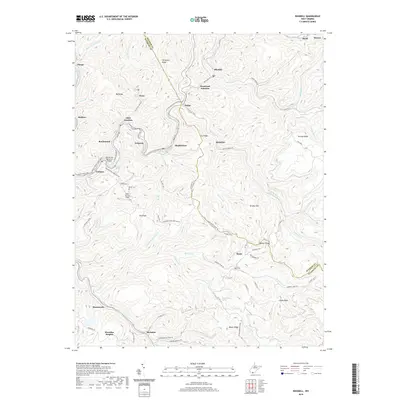
2019 Map of Rhodell
USGS Topo · Published 2019About this map
The Guyandotte River carves through the steep ridges of the West Virginia coalfields, anchoring a string of valley settlements like Stephenson, Amigo, and Mullens. This 2019 survey documents the rugged geography where the borders of Raleigh and Wyoming counties meet, highlighting a landscape defined by narrow hollows and high ridges such as Horsepen Ridge and Ivy Ridge. The transport network follows these natural corridors, with the Winding Gulf railroad line tracing the water's edge alongside the Roy M Lilly Memorial Bridge.
Find a feature on this map
86 named features on this map. Tap any name to fly to it.
Don’t see what you’re looking for? This feature index may not catch every label — zoom into the map to look around manually.
Map Details
Editions of this 2019 Rhodell Map
This is the sole edition of this map. No revisions or reprints were ever made.
Other maps of this area

1887 · Pocahontas
USGS Topo · 1:125,000

1891 · Pocahontas
USGS Topo · 1:125,000

1891 · Raleigh
USGS Topo · 1:125,000

1894 · Pocahontas
USGS Topo · 1:125,000

1895 · Pocahontas
USGS Topo · 1:125,000

1897 · Raleigh
USGS Topo · 1:125,000

1902 · Raleigh
USGS Topo · 1:125,000

1909 · Pocahontas Special
USGS Topo · 1:48,000

1911 · Flattop
USGS Topo · 1:48,000

1911 · Pocahontas Special
USGS Topo · 1:62,500