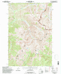
1994 Map of Rhodes Peak
USGS Topo · Published 1997About this map
Rhodes Peak dominates this high-altitude landscape along the border of Idaho and Montana, where the Clearwater National Forest meets the Lolo National Forest. The map documents a rugged drainage system defined by Kelly Creek and its various forks, with elevations rising sharply toward the Williams Range. Human activity is concentrated in the southern reaches, where evidence of prospecting is clear near Blacklead Mtn. In this sector, markers for Mines and the Black Lead site appear alongside a recorded Grave, suggesting the difficult conditions of early mountain exploration. High basins hold remote water bodies like Smokey Lake and Goat Lake, while landmarks such as Kellys Finger and Kellys Sister orient travelers. The division between the Ninemile Ranger District and Powell Ranger District further structures this backcountry terrain.
Find a feature on this map
39 named features on this map. Tap any name to fly to it.
Don’t see what you’re looking for? This feature index may not catch every label — zoom into the map to look around manually.
Map Details
Editions of this 1994 Rhodes Peak Map
This is the sole edition of this map. No revisions or reprints were ever made.
Other maps of this area

1911 · Lolo
USGS Topo · 1:250,000

1913 · Lolo
USGS Topo · 1:250,000

1956 · Hamilton
USGS Topo · 1:250,000

1959 · Hamilton
USGS Topo · 1:250,000

1960 · Hamilton
USGS Topo · 1:250,000

1960 · Straight Peak
USGS Topo · 1:62,500

1964 · Hamilton
USGS Topo · 1:250,000

1964 · Rocky Point
USGS Topo · 1:24,000
1964 · White Mountain
USGS Topo · 1:24,000
1964 · Granite Pass
USGS Topo · 1:24,000