
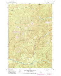
1964 Map of Rocky Point
USGS Topo · Published 1967About this map
The Lochsa River valley serves as the central corridor for this mid-1960s survey within the Clearwater National Forest. The landscape is defined by the convergence of major waterways, including White Sand Creek and Crooked Fork, which supported a growing recreational and administrative presence. Key hubs like the Powell Ranger Station and Lochsa Lodge are documented near the water's edge, alongside facilities like White Sand Campground and Powell Campground. Beyond the valley floor, the terrain rises sharply toward named peaks and ridges such as Rocky Point, Parachute Hill, and the high pass at Papoose Saddle. This map records the integration of forest service infrastructure with local landmarks like Star Meadows and the Cedar Grove Picnic Area at a time when the area's timber and recreational value were being formalized.
Find a feature on this map
28 named features on this map. Tap any name to fly to it.
Don’t see what you’re looking for? This feature index may not catch every label — zoom into the map to look around manually.
Map Details
Editions of this 1964 Rocky Point Map
2 editions found
Other maps of this area

1911 · Lolo
USGS Topo · 1:250,000

1913 · Lolo
USGS Topo · 1:250,000

1956 · Hamilton
USGS Topo · 1:250,000

1959 · Hamilton
USGS Topo · 1:250,000

1960 · Hamilton
USGS Topo · 1:250,000

1964 · Hamilton
USGS Topo · 1:250,000

1964 · Lolo Hot Springs
USGS Topo · 1:24,000

1964 · Roundtop
USGS Topo · 1:24,000
1964 · Granite Pass
USGS Topo · 1:24,000

1966 · Grave Peak
USGS Topo · 1:24,000