1987 Map of Rhyolite Ridge NE
USGS Topo · Published 1987About this map
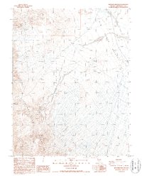
The Silver Peak Range dominates this corner of Esmeralda County, providing a stark topographical contrast to the broad expanse of the Big Smoky Valley to the east. This 1987 provisional survey documents an area shaped by historical mining and transportation, most notably along the western slopes where the Dams Mine and an Open Pit Mine are situated near a high concentration of unnamed Prospects.
Find a feature on this map
14 named features on this map. Tap any name to fly to it.
Don’t see what you’re looking for? This feature index may not catch every label — zoom into the map to look around manually.
Map Details
Editions of this 1987 Rhyolite Ridge NE Map
This is the sole edition of this map. No revisions or reprints were ever made.
Other maps of this area

1898 · Silver Peak
USGS Topo · 1:125,000

1900 · Silver Peak
USGS Topo · 1:125,000

1907 · Tonopah
USGS Topo · 1:250,000

1908 · Lida
USGS Topo · 1:250,000

1908 · Tonopah
USGS Topo · 1:250,000

1913 · Lida
USGS Topo · 1:250,000

1954 · Goldfield
USGS Topo · 1:250,000

1955 · Goldfield
USGS Topo · 1:250,000

1956 · Tonopah
USGS Topo · 1:250,000

1958 · Goldfield
USGS Topo · 1:250,000