
1958 Map of Goldfield
USGS Topo · Published 1958About this map
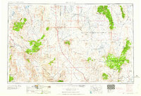
Goldfield stands at the center of this high-desert landscape in the late 1950s, a region defined by its transition from boomtown mining to modern military operations. The map details a rugged interior where the Las Vegas Bombing and Gunnery Range occupies a vast portion of Pahute Mesa and Stonewall Flat. Evidence of the area's rich prospecting history is scattered throughout the Silver Peak Mountains and Slate Ridge, marked by a dismantled railroad and Numerous mines near Klondike. To the south, the borders of Death Valley National Monument frame iconic landmarks like Scotty's Castle and the remote Staininger's Ranch. Vital water sources, essential for survival in this arid terrain, are meticulously documented, including Antelope Springs, Pigeon Spring, and the Ramsey Well. This survey captures the isolation and strategic importance of the Nevada-California borderlands just as the nuclear age reshaped the territory.
Find a feature on this map
107 named features on this map. Tap any name to fly to it.
Don’t see what you’re looking for? This feature index may not catch every label — zoom into the map to look around manually.
Map Details
Editions of this 1958 Goldfield Map
2 editions found
Other maps of this area

1898 · Silver Peak
USGS Topo · 1:125,000

1900 · Silver Peak
USGS Topo · 1:125,000

1907 · Mt. Whitney
USGS Topo · 1:125,000

1907 · Tonopah
USGS Topo · 1:250,000

1907 · Las Vegas
USGS Topo · 1:250,000

1908 · Kawich
USGS Topo · 1:250,000

1908 · Lida
USGS Topo · 1:250,000

1908 · Furnace Creek
USGS Topo · 1:250,000

1908 · Las Vegas
USGS Topo · 1:250,000

1908 · Tonopah
USGS Topo · 1:250,000