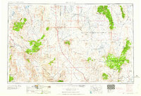
1958 Map of Goldfield
USGS Topo · Published 1958About this map
Goldfield and the surrounding high desert of Esmeralda and Nye counties are captured here in a moment of transition during the late 1950s. While the area is marked by a legacy of mining, evidenced by Numerous mines and specific deposits of Silver and lead and Tungsten, the landscape reflects the growing military and conservation footprints of the era. The vast Las Vegas Bombing and Gunnery Range dominates the central and eastern basins, including Cactus Flat and Kawich Valley. To the southwest, the northern reaches of Death Valley National Monument protect iconic landmarks such as Scotty's Castle. Transportation networks show the evolution of the region, featuring a dismantled railroad alongside modern routes like Highway 95, which passes through Scotty's Junction and Springdale. Remote outposts and water sources like Bonnie Claire, Klondike, and Stinking Spring remain vital points in an arid terrain defined by the Silver Peak Mountains and Pahute Mesa.
Find a feature on this map
76 named features on this map. Tap any name to fly to it.
Don’t see what you’re looking for? This feature index may not catch every label — zoom into the map to look around manually.
Map Details
Editions of this 1958 Goldfield Map
2 editions found

Other maps of this area

1898 · Silver Peak
USGS Topo · 1:125,000

1900 · Silver Peak
USGS Topo · 1:125,000

1907 · Mt. Whitney
USGS Topo · 1:125,000

1907 · Tonopah
USGS Topo · 1:250,000

1907 · Las Vegas
USGS Topo · 1:250,000

1908 · Kawich
USGS Topo · 1:250,000

1908 · Lida
USGS Topo · 1:250,000

1908 · Furnace Creek
USGS Topo · 1:250,000

1908 · Las Vegas
USGS Topo · 1:250,000

1908 · Tonopah
USGS Topo · 1:250,000