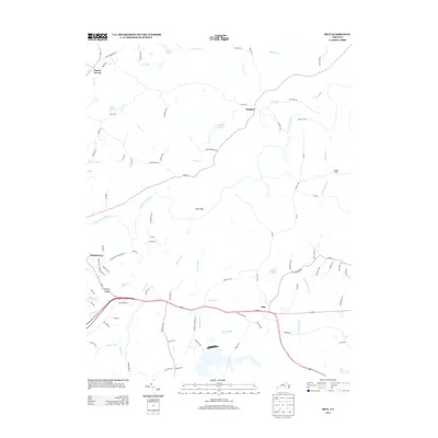
2013 Map of Rice
USGS Topo · Published 2013About this map
The Appomattox River winds through this central Virginia landscape, defining the boundaries and transport patterns of Prince Edward County. The map features the crossing at High Bridge, a landmark of significant regional engineering and historical weight, situated between Farmville and the settlement of Rice. The terrain is defined by a dense network of tributaries including Bush River, Sandy River, and Angola Cr, which feed into various man-made and natural catchments like Wilsons Pond and Wilks Pond.
Find a feature on this map
91 named features on this map. Tap any name to fly to it.
Don’t see what you’re looking for? This feature index may not catch every label — zoom into the map to look around manually.
Map Details
Editions of this 2013 Rice Map
This is the sole edition of this map. No revisions or reprints were ever made.
Other maps of this area

1891 · Farmville
USGS Topo · 1:125,000

1893 · Farmville
USGS Topo · 1:125,000

1947 · Roanoke
USGS Topo · 1:250,000

1958 · Farmville
USGS Topo · 1:62,500

1958 · Jetersville
USGS Topo · 1:62,500

1958 · Crewe
USGS Topo · 1:62,500

1958 · Keysville
USGS Topo · 1:62,500

1959 · Roanoke
USGS Topo · 1:250,000

1963 · Roanoke
USGS Topo · 1:250,000
1968 · Farmville
USGS Topo · 1:24,000