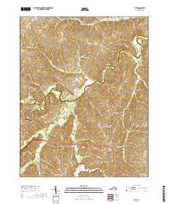
2019 Map of Rice
USGS Topo · Published 2019About this map
Farmville and the nearby settlement of Rice anchor this landscape along the boundary of Cumberland and Prince Edward counties. The topography is defined by the winding course of the Appomattox River, which is famously spanned by the High Bridge landmark. This area, long shaped by its river systems, shows a complex network of tributaries including the Bush River, Sandy River, and Angola Creek. Small community centers like Stoddert and Raines Tavern are visible in the northern reaches, while the southern section is dotted with historic family and community landmarks. Genealogists will find several notable burial grounds, including the High Bridge Cemetery, Jamestown Cemetery, and Bethel Grove Cemetery, which provide clues to the region's long-standing rural settlement patterns. The land remains largely defined by its natural drainage, from Wilcks Pond in the north to Hines Pond in the south.
Find a feature on this map
97 named features on this map. Tap any name to fly to it.
Don’t see what you’re looking for? This feature index may not catch every label — zoom into the map to look around manually.
Map Details
Editions of this 2019 Rice Map
This is the sole edition of this map. No revisions or reprints were ever made.
Other maps of this area

1891 · Farmville
USGS Topo · 1:125,000

1893 · Farmville
USGS Topo · 1:125,000

1947 · Roanoke
USGS Topo · 1:250,000

1958 · Farmville
USGS Topo · 1:62,500

1958 · Jetersville
USGS Topo · 1:62,500

1958 · Crewe
USGS Topo · 1:62,500

1958 · Keysville
USGS Topo · 1:62,500

1959 · Roanoke
USGS Topo · 1:250,000

1963 · Roanoke
USGS Topo · 1:250,000
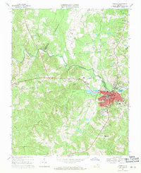
1968 · Farmville
USGS Topo · 1:24,000