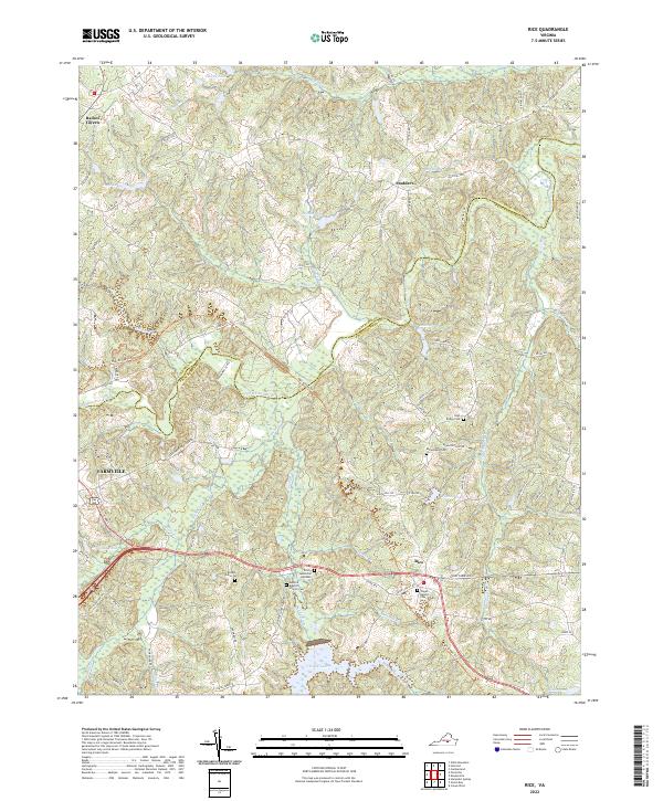
2022 Map of Rice
USGS Topo · Published 2022About this map
The Appomattox River winds through the heart of this Virginia landscape, marking the historic boundary between Cumberland and Prince Edward counties. The area's settlement pattern is defined by rural communities like Rice and Stoddert, alongside the eastern edge of Farmville. A notable transportation feature is the High Bridge Trl, which follows the old rail corridor through the countryside. Genealogy researchers will find several local landmarks, including the Bethel Grove Cem, Monroe Baptist Church Cem, and Jamestown Cem. The terrain is deeply etched by a network of waterways such as the Bush River, Sandy River, and Angola Cr, which feed into various ponds and reservoirs like Hicks Lake and Millwood Pond. This map details the local road network, from established routes like Cooks Rd to smaller connectors such as Gully Tavern Rd.
Find a feature on this map
82 named features on this map. Tap any name to fly to it.
Don’t see what you’re looking for? This feature index may not catch every label — zoom into the map to look around manually.
Map Details
Editions of this 2022 Rice Map
This is the sole edition of this map. No revisions or reprints were ever made.
Other maps of this area

1891 · Farmville
USGS Topo · 1:125,000

1893 · Farmville
USGS Topo · 1:125,000

1947 · Roanoke
USGS Topo · 1:250,000

1958 · Farmville
USGS Topo · 1:62,500

1958 · Jetersville
USGS Topo · 1:62,500

1958 · Crewe
USGS Topo · 1:62,500

1958 · Keysville
USGS Topo · 1:62,500

1959 · Roanoke
USGS Topo · 1:250,000

1963 · Roanoke
USGS Topo · 1:250,000
1968 · Farmville
USGS Topo · 1:24,000