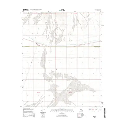
2015 Map of Rice
USGS Topo · Published 2015About this map
Rice stands as a focal point in the California desert, positioned at the intersection of Blythe Rice Rd and Midland Rd. This arid expanse, largely defined by the broad Rice Valley, is bisected by the massive engineering works of the Colorado River Aqueduct. The map illustrates a landscape of stark contrasts, where linear infrastructure projects cut across the open basin floor. The boundary between San Bernardino County and Riverside County runs horizontally through the center of the survey, marking a jurisdictional divide in this sparsely populated region. The presence of these specific road networks and the aqueduct highlights the area's importance as a transit corridor for both water and regional travel through the Mojave Desert interior.
Find a feature on this map
12 named features on this map. Tap any name to fly to it.
Don’t see what you’re looking for? This feature index may not catch every label — zoom into the map to look around manually.
Map Details
Editions of this 2015 Rice Map
This is the sole edition of this map. No revisions or reprints were ever made.
Other maps of this area

1942 · Blythe
USGS Topo · 1:250,000

1943 · Vidal
USGS Topo · 1:62,500

1945 · Big Maria Mtns
USGS Topo · 1:62,500

1945 · Midland
USGS Topo · 1:62,500

1949 · Vidal
USGS Topo · 1:62,500

1950 · Vidal
USGS Topo · 1:62,500

1951 · Big Maria Mts
USGS Topo · 1:62,500

1952 · Midland
USGS Topo · 1:62,500

1954 · Salton Sea
USGS Topo · 1:250,000

1954 · Needles
USGS Topo · 1:250,000