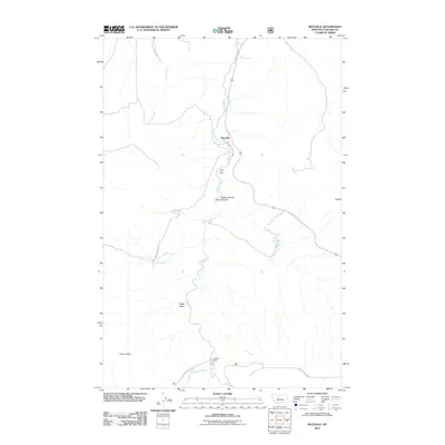
2011 Map of Riceville
USGS Topo · Published 2011About this map
Belt Creek serves as the central artery of this landscape, carving through a region defined by dramatic elevation shifts and secluded drainage systems. Near the northern settlement of Riceville, the creek passes through the unique geological formations of the Nasen Coulee Sluice Boxes, where the narrow canyon walls create a distinct natural waterway. This 2011 survey captures a mix of recreational and residential sites, including Camp Don Bosco, positioned along the creek banks south of the town center.
Find a feature on this map
12 named features on this map. Tap any name to fly to it.
Don’t see what you’re looking for? This feature index may not catch every label — zoom into the map to look around manually.
Map Details
Editions of this 2011 Riceville Map
This is the sole edition of this map. No revisions or reprints were ever made.
Other maps of this area

1886 · Great Falls
USGS Topo · 1:250,000

1890 · Fort Benton
USGS Topo · 1:250,000

1892 · Fort Benton
USGS Topo · 1:250,000

1897 · Fort Benton
USGS Topo · 1:250,000

1954 · Great Falls
USGS Topo · 1:250,000

1955 · Stockett
USGS Topo · 1:62,500

1956 · Belt
USGS Topo · 1:62,500

1957 · Great Falls
USGS Topo · 1:250,000

1965 · Mahoney Hill
USGS Topo · 1:24,000
1967 · Monarch NE
USGS Topo · 1:24,000