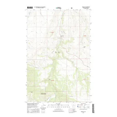
2017 Map of Riceville
USGS Topo · Published 2017About this map
Belt Creek winds through the heart of this landscape, carving a canyon-like path past the settlement of Riceville and the geological formation known as Sluice Boxes. This 2017 survey reveals a transition from the lower creek valley to the elevated reaches of the Lewis & Clark National Forest, where the terrain is marked by prominent features like Crown Butte. The network of local routes, including Evans Riceville Rd and Logging Creek Rd, highlights the area's history of resource access and mountain navigation.
Find a feature on this map
22 named features on this map. Tap any name to fly to it.
Don’t see what you’re looking for? This feature index may not catch every label — zoom into the map to look around manually.
Map Details
Editions of this 2017 Riceville Map
This is the sole edition of this map. No revisions or reprints were ever made.
Other maps of this area

1886 · Great Falls
USGS Topo · 1:250,000

1890 · Fort Benton
USGS Topo · 1:250,000

1892 · Fort Benton
USGS Topo · 1:250,000

1897 · Fort Benton
USGS Topo · 1:250,000

1954 · Great Falls
USGS Topo · 1:250,000

1955 · Stockett
USGS Topo · 1:62,500

1956 · Belt
USGS Topo · 1:62,500

1957 · Great Falls
USGS Topo · 1:250,000

1965 · Mahoney Hill
USGS Topo · 1:24,000
1967 · Monarch NE
USGS Topo · 1:24,000