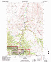
1995 Map of Riceville
USGS Topo · Published 1997About this map
Belt Creek carves a central canyon through this landscape on the northern edge of the Little Belt Mountains, defining the development and transit of the region. The small settlement of Riceville serves as the primary landmark, situated where the waterway meets an Old Railroad Grade and several key mountain drainages. The influence of the U.S. Forest Service is evident in the southern portion of the map, which covers the Lewis and Clark National Forest and the Kings Hill Ranger District. Local history and recreation are marked by Camp Don Bosco and the Isaac Walton Spring, while industrial relics like a Gravel Pit near Tiger Creek point to past resource extraction. The map also captures the complex surveying boundaries of the 4th Standard Parallel North and the Mountain Guide Meridian crossing through these steep coulees and gulches.
Find a feature on this map
23 named features on this map. Tap any name to fly to it.
Don’t see what you’re looking for? This feature index may not catch every label — zoom into the map to look around manually.
Map Details
Editions of this 1995 Riceville Map
This is the sole edition of this map. No revisions or reprints were ever made.
Other maps of this area

1886 · Great Falls
USGS Topo · 1:250,000

1890 · Fort Benton
USGS Topo · 1:250,000

1892 · Fort Benton
USGS Topo · 1:250,000

1897 · Fort Benton
USGS Topo · 1:250,000

1954 · Great Falls
USGS Topo · 1:250,000

1955 · Stockett
USGS Topo · 1:62,500

1956 · Belt
USGS Topo · 1:62,500

1957 · Great Falls
USGS Topo · 1:250,000

1965 · Mahoney Hill
USGS Topo · 1:24,000
1967 · Monarch NE
USGS Topo · 1:24,000