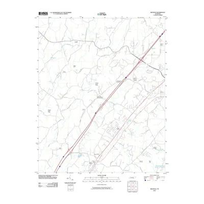
2010 Map of Riceville
USGS Topo · Published 2010About this map
Riceville Post Office serves as a central landmark for this McMinn County landscape at the turn of the 21st century. The map reveals a community structured by family names and long-standing institutions, where topographic features like Ward Bluff and Rogers Creek Ridge dictate the winding paths of rural roads. Genealogists will find a high density of burial grounds, ranging from the prominent Union Chapel United Methodist Church Cemetery to smaller family sites like Dennis Cemetery and Sullins Cemetery. The drainage of the region is punctuated by numerous named springs and reservoirs, including Bell Spring and Blazer Lake. To the southeast, the William Browder Dam and William Browder Lake mark significant water management on the landscape, while the Chilohowee Rod and Gun Club Lake reflects local recreational history. This survey provides a precise view of the rural-residential patterns as they existed before further modern development altered these traditional property lines.
Find a feature on this map
93 named features on this map. Tap any name to fly to it.
Don’t see what you’re looking for? This feature index may not catch every label — zoom into the map to look around manually.
Map Details
Editions of this 2010 Riceville Map
This is the sole edition of this map. No revisions or reprints were ever made.
Other maps of this area

1886 · Cleveland
USGS Topo · 1:125,000

1887 · Kingston
USGS Topo · 1:125,000

1891 · Kingston
USGS Topo · 1:125,000

1892 · Cleveland
USGS Topo · 1:125,000

1893 · Kingston
USGS Topo · 1:125,000

1895 · Cleveland
USGS Topo · 1:125,000

1901 · Cleveland
USGS Topo · 1:125,000

1935 · Niota
USGS Topo · 1:24,000

1935 · Calhoun
USGS Topo · 1:24,000

1935 · Athens
USGS Topo · 1:24,000