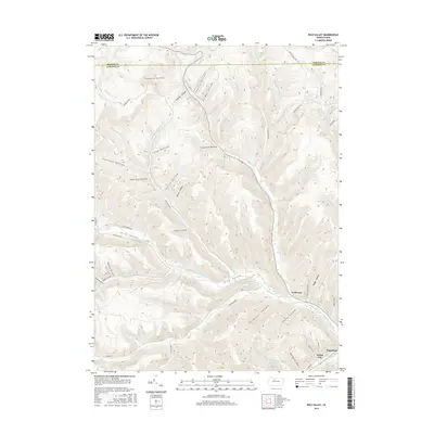
2016 Map of Rich Valley
USGS Topo · Published 2016About this map
Rich Valley serves as a primary geographic corridor in this section of the Allegheny Plateau, where the Driftwood Branch Sinnemahoning Creek carves a deep path toward Emporium. This 2016 survey illustrates the rugged drainage patterns of the region, defined by long, named hollows such as Twelve Hollow, Fourmile Hollow, and the peculiarly named Six and One Half Mile Hollow. The settlement pattern follows the narrow valley floors, with small communities like Lockwood and Weber City situated along the primary watercourses and road networks. Evidence of the region’s resource-based history remains in labels like Oil Well Hollow, reflecting the legacy of Pennsylvania’s northern oil and gas fields. Significant infrastructure includes the Emporium Reservoir nestled in the southern hills and a complex network of forestry and township roads such as Cooks Run Rd and Dividing Ridge Rd that provide access to the high ridges.
Find a feature on this map
71 named features on this map. Tap any name to fly to it.
Don’t see what you’re looking for? This feature index may not catch every label — zoom into the map to look around manually.
Map Details
Editions of this 2016 Rich Valley Map
This is the sole edition of this map. No revisions or reprints were ever made.
Other maps of this area

1941 · Benezette
USGS Topo · 1:62,500

1943 · Benezette
USGS Topo · 1:62,500

1945 · Driftwood
USGS Topo · 1:48,000

1945 · Cameron
USGS Topo · 1:24,000

1947 · Cameron
USGS Topo · 1:24,000

1948 · Crosby
USGS Topo · 1:62,500

1948 · Emporium
USGS Topo · 1:62,500

1948 · Keating Summit
USGS Topo · 1:24,000

1948 · Emporium
USGS Topo · 1:24,000

1948 · Wildwood Fire Tower
USGS Topo · 1:24,000
Featured Places
- Norwich Township, PA
- Weber City, Shippen Township
- Shippen Township, PA
- Lawn View, Shippen Township
- Lockwood, Shippen Township