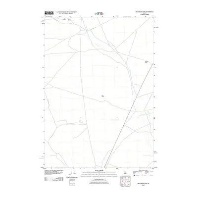
2010 Map of Richard Butte
USGS Topo · Published 2010About this map
Goddard Cemetery sits near the northern boundary of this high desert landscape, marking a site of genealogical interest amid the volcanic geography of Butte County. The terrain is defined by sweeping geological formations, including Lava Ridge and the eponymous Richard Butte, which rises above the surrounding flats. The seasonal flow of Birch Creek threads through the eastern portion of the quadrangle, illustrating the drainage patterns that dictate life in this arid region. Transportation across these open spaces relies on a network of unpaved routes like West Foothill Rd and Mahogany Butte Rd, which navigate the dips of Tyler Canyon and Kyle Canyon. This survey captures a moment in the modern management of these public lands, showing how contemporary road networks such as Cutoff Rd interact with established natural landmarks.
Find a feature on this map
9 named features on this map. Tap any name to fly to it.
Don’t see what you’re looking for? This feature index may not catch every label — zoom into the map to look around manually.
Map Details
Editions of this 2010 Richard Butte Map
This is the sole edition of this map. No revisions or reprints were ever made.
Other maps of this area

1955 · Dubois
USGS Topo · 1:250,000

1955 · Idaho Falls
USGS Topo · 1:250,000

1958 · Dubois
USGS Topo · 1:250,000

1958 · Idaho Falls
USGS Topo · 1:250,000

1969 · Little Lost River Sinks
USGS Topo · 1:24,000

1969 · Circular Butte
USGS Topo · 1:24,000

1969 · Circular Butte NW
USGS Topo · 1:24,000

1969 · Eightmile Canyon
USGS Topo · 1:24,000

1969 · Richard Butte
USGS Topo · 1:24,000

1969 · Tyler Peak
USGS Topo · 1:24,000