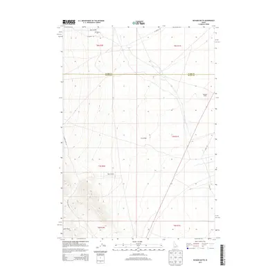
2013 Map of Richard Butte
USGS Topo · Published 2013About this map
Goddard Cem rests near Tyler Canyon in this corner of Idaho, where the high desert terrain meets the southern extent of the Lemhi Range. The landscape is defined by its volcanic geology and drainage patterns, specifically the presence of Lava Ridge and the prominent Richard Butte rising above the surrounding flats. The seasonal flow of Birch Cr cuts through the northeast, crossing the boundary between Butte County and Clark County. This 2013 survey illustrates a sparsely populated region primarily utilized for cattle ranging and transit, with long-established routes like W Foothill Rd and Mahogany Butte Rd skirting the foothills. Geologic and geographic features dominate the map, from the deep incisions of Kyle Canyon to the wide alluvial plains that characterize the area's transition into the desert basin.
Find a feature on this map
17 named features on this map. Tap any name to fly to it.
Don’t see what you’re looking for? This feature index may not catch every label — zoom into the map to look around manually.
Map Details
Editions of this 2013 Richard Butte Map
This is the sole edition of this map. No revisions or reprints were ever made.
Other maps of this area

1955 · Dubois
USGS Topo · 1:250,000

1955 · Idaho Falls
USGS Topo · 1:250,000

1958 · Dubois
USGS Topo · 1:250,000

1958 · Idaho Falls
USGS Topo · 1:250,000

1969 · Little Lost River Sinks
USGS Topo · 1:24,000

1969 · Circular Butte
USGS Topo · 1:24,000

1969 · Circular Butte NW
USGS Topo · 1:24,000

1969 · Eightmile Canyon
USGS Topo · 1:24,000

1969 · Richard Butte
USGS Topo · 1:24,000

1969 · Tyler Peak
USGS Topo · 1:24,000