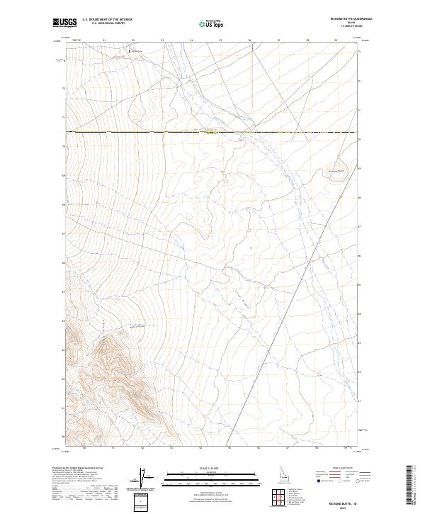
2023 Map of Richard Butte
USGS Topo · Published 2023About this map
Lemhi Range peaks dominate the southwestern corner of this Idaho landscape, giving way to the expansive volcanic features and alluvial plains characteristic of the Snake River Plain edge. The ephemeral waters of Birch Creek traverse the terrain from northwest to southeast, cutting a path through the high desert floor near the base of Lava Ridge. This area serves as a transition between the high limestone ridges and the volcanic outcrops that define the local topography.
Find a feature on this map
14 named features on this map. Tap any name to fly to it.
Don’t see what you’re looking for? This feature index may not catch every label — zoom into the map to look around manually.
Map Details
Editions of this 2023 Richard Butte Map
This is the sole edition of this map. No revisions or reprints were ever made.
Other maps of this area

1955 · Dubois
USGS Topo · 1:250,000

1955 · Idaho Falls
USGS Topo · 1:250,000

1958 · Dubois
USGS Topo · 1:250,000

1958 · Idaho Falls
USGS Topo · 1:250,000

1969 · Little Lost River Sinks
USGS Topo · 1:24,000

1969 · Circular Butte
USGS Topo · 1:24,000

1969 · Circular Butte NW
USGS Topo · 1:24,000

1969 · Eightmile Canyon
USGS Topo · 1:24,000

1969 · Richard Butte
USGS Topo · 1:24,000

1969 · Tyler Peak
USGS Topo · 1:24,000