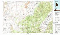
1980 Map of Richfield
USGS Topo · Published 1987About this map
Richfield serves as the focal point of the Sevier River valley in this 1980 survey, where the agricultural corridors of Pavant Valley meet the rising elevations of the Fishlake National Forest. The map captures a transition between the volcanic features of Tabernacle Crater and Tabernacle Hill in the north and the deep canyons of the Pavant Range and Tushar Mountains. The transportation network is anchored by the Union Pacific and Denver and Rio Grande Western railroads, reflecting the region's importance as a transit hub between the Cricket Mountains and the high plateaus. Researchers can trace the Old Indian Reservation Boundary as it cuts across the landscape, providing a window into the historical land divisions of Millard Co and Sevier Co. Small agricultural settlements like Kanosh, Meadow, and Elsinore are well-defined, showing the enduring pattern of valley irrigation along the Sevier River and Cove Creek.
Find a feature on this map
74 named features on this map. Tap any name to fly to it.
Don’t see what you’re looking for? This feature index may not catch every label — zoom into the map to look around manually.
Map Details
Editions of this 1980 Richfield Map
2 editions found

Other maps of this area

1885 · Manti
USGS Topo · 1:250,000

1885 · Beaver
USGS Topo · 1:250,000

1885 · Sevier Desert
USGS Topo · 1:250,000

1885 · Fish Lake
USGS Topo · 1:250,000

1895 · Manti
USGS Topo · 1:250,000

1896 · Fish Lake
USGS Topo · 1:250,000

1908 · Fish Springs
USGS Topo · 1:250,000

1910 · Fish Springs
USGS Topo · 1:250,000

1932 · Sevier
USGS Topo · 1:62,500

1935 · Sevier
USGS Topo · 1:62,500