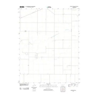
2010 Map of Richfield NW
USGS Topo · Published 2010About this map
Satanta Municipal Airport occupies the northwestern corner of this High Plains landscape, serving as a distinct aeronautical landmark in an area otherwise defined by a meticulous grid of rural section roads. The terrain is bisected by the winding course of Sand Arroyo Creek, which cuts a natural path across the structured geometry of the county's transportation network. This map illustrates a transition in regional travel, showing the prominent diagonal route of US Hwy 160 as it cuts across the northern reaches, while local thoroughfares like S Manter Grade and DD Blvd provide the essential framework for accessing the surrounding agricultural tracts. The scarcity of named structures emphasizes the open, rural character of this Stanton County landscape in the early 21st century.
Find a feature on this map
16 named features on this map. Tap any name to fly to it.
Don’t see what you’re looking for? This feature index may not catch every label — zoom into the map to look around manually.
Map Details
Editions of this 2010 Richfield NW Map
This is the sole edition of this map. No revisions or reprints were ever made.
Other maps of this area

1891 · Albany
USGS Topo · 1:125,000

1892 · Vilas
USGS Topo · 1:125,000

1893 · Albany
USGS Topo · 1:125,000

1900 · Syracuse
USGS Topo · 1:125,000

1920 · Syracuse
USGS Topo · 1:125,000

1955 · La Junta
USGS Topo · 1:250,000

1955 · Dodge City
USGS Topo · 1:250,000

1958 · La Junta
USGS Topo · 1:250,000

1958 · Dodge City
USGS Topo · 1:250,000

1959 · Dodge City
USGS Topo · 1:250,000