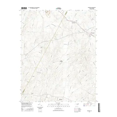
2016 Map of Richfield
USGS Topo · Published 2016About this map
Misenheimer and Richfield serve as the primary hubs in this section of the North Carolina piedmont, where the boundary between Cabarrus and Stanly counties follows the winding paths of local waterways. The landscape is defined by a dense network of creeks, including Little Buffalo Cr and Curi Tail Cr, which flow through a region historically shaped by rural industry and agriculture. Smaller settlements like Pauls Crossing, Finger, and Millingport are connected by a web of named country roads, such as Old Mine Rd and Gold Hill Rd E, hinting at the area's geological and mining heritage. Aviation is represented by local facilities like LZ Carroll Airport and Bear Creek Airport, providing a modern contrast to the traditional landmarks such as Mattons Grove Church Rd and Bear Creek Church Rd that anchor these communities.
Find a feature on this map
91 named features on this map. Tap any name to fly to it.
Don’t see what you’re looking for? This feature index may not catch every label — zoom into the map to look around manually.
Map Details
Editions of this 2016 Richfield Map
This is the sole edition of this map. No revisions or reprints were ever made.
Other maps of this area

1949 · High Rock
USGS Topo · 1:24,000

1953 · Charlotte
USGS Topo · 1:250,000

1954 · Charlotte
USGS Topo · 1:250,000

1957 · Mount Pleasant
USGS Topo · 1:62,500

1957 · Albemarle
USGS Topo · 1:62,500

1957 · Denton
USGS Topo · 1:62,500

1960 · Charlotte
USGS Topo · 1:250,000

1962 · Charlotte
USGS Topo · 1:250,000
1962 · Gold Hill
USGS Topo · 1:24,000
1962 · Rockwell
USGS Topo · 1:24,000