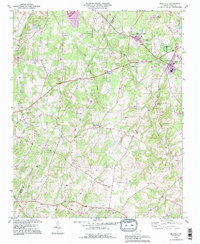
1993 Map of Richfield
USGS Topo · Published 1996About this map
Pfeiffer College serves as a prominent landmark in the northern portion of this landscape, situated near Misenheimer and the confluence of Tail Curl Creek and Long Creek. This survey captures the rural character of northern Stanly County in the early 1990s, with updates reflecting shifts in land use near the Richfield town center. The area is defined by a dense network of small communities and family-named locations such as Pauls Crossing, Millingport, and Finger, many of which grew around crossroads and local water sources like Bear Creek.
Find a feature on this map
39 named features on this map. Tap any name to fly to it.
Don’t see what you’re looking for? This feature index may not catch every label — zoom into the map to look around manually.
Map Details
Editions of this 1993 Richfield Map
This is the sole edition of this map. No revisions or reprints were ever made.
Other maps of this area

1949 · High Rock
USGS Topo · 1:24,000

1953 · Charlotte
USGS Topo · 1:250,000

1954 · Charlotte
USGS Topo · 1:250,000

1957 · Mount Pleasant
USGS Topo · 1:62,500

1957 · Albemarle
USGS Topo · 1:62,500

1957 · Denton
USGS Topo · 1:62,500

1960 · Charlotte
USGS Topo · 1:250,000

1962 · Charlotte
USGS Topo · 1:250,000
1962 · Gold Hill
USGS Topo · 1:24,000
1962 · Rockwell
USGS Topo · 1:24,000