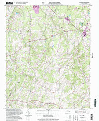
2002 Map of Richfield
USGS Topo · Published 2003About this map
Pfeiffer College serves as a focal point for the Misenheimer area, situated along the rail line that connects this academic hub to the nearby town of Richfield. The landscape is defined by the headwaters of Buffalo Creek, Long Creek, and Big Bear Creek, which drain the rolling terrain of western Stanly County. Small rural communities like Millingport, Mattons Grove, and Finger reveal a settlement pattern deeply rooted in agriculture and local industry, with numerous country churches such as St Stephens Ch and New Bethel Ch serving as historic landmarks for genealogists. The presence of the Bear Creek Airport and the rail-oriented layout of Misenheimer Springs Station reflect a transition between traditional Piedmont farming and the infrastructure of modern transportation and education that shaped the region during the late 20th century.
Find a feature on this map
49 named features on this map. Tap any name to fly to it.
Don’t see what you’re looking for? This feature index may not catch every label — zoom into the map to look around manually.
Map Details
Editions of this 2002 Richfield Map
This is the sole edition of this map. No revisions or reprints were ever made.
Other maps of this area

1949 · High Rock
USGS Topo · 1:24,000

1953 · Charlotte
USGS Topo · 1:250,000

1954 · Charlotte
USGS Topo · 1:250,000

1957 · Mount Pleasant
USGS Topo · 1:62,500

1957 · Albemarle
USGS Topo · 1:62,500

1957 · Denton
USGS Topo · 1:62,500

1960 · Charlotte
USGS Topo · 1:250,000

1962 · Charlotte
USGS Topo · 1:250,000
1962 · Gold Hill
USGS Topo · 1:24,000
1962 · Rockwell
USGS Topo · 1:24,000