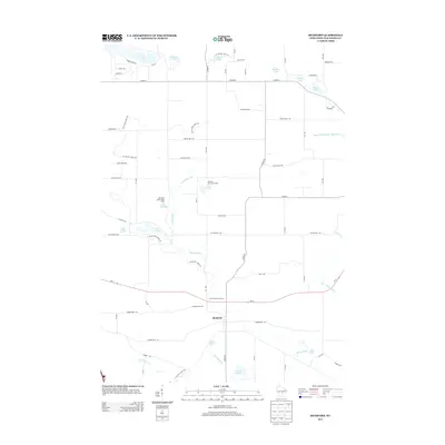
2013 Map of Richford
USGS Topo · Published 2013About this map
The Mecan River headwaters define this central Wisconsin landscape, which is largely shaped by its glacial legacy. The Ice Age Natl Scenic Trl winds through the western half of the quadrangle, passing near glacial features like Mecan Springs and Fish Lake. The settlement of Richford serves as a central hub, surrounded by a network of recreational camps and numerous small kettle lakes. In the early 21st century, the area maintains its character as a destination for outdoor youth organizations, evidenced by the American Legion Boys Camp on Lake Jeanette and the Merriam Boy Scout Camp on Lake Virginia. To the east, the Upper White River Millpond 1 indicates the historical utility of local waterways for milling, while the surrounding grid of county highways and named forest paths connects these water bodies and residential pockets.
Find a feature on this map
63 named features on this map. Tap any name to fly to it.
Don’t see what you’re looking for? This feature index may not catch every label — zoom into the map to look around manually.
Map Details
Editions of this 2013 Richford Map
This is the sole edition of this map. No revisions or reprints were ever made.
Other maps of this area

1955 · Green Bay
USGS Topo · 1:250,000

1957 · Madison
USGS Topo · 1:250,000

1958 · Coloma
USGS Topo · 1:48,000

1959 · Wautoma
USGS Topo · 1:48,000

1960 · Madison
USGS Topo · 1:250,000

1961 · Oxford
USGS Topo · 1:62,500

1961 · Montello
USGS Topo · 1:62,500

1968 · Coloma
USGS Topo · 1:24,000

1968 · Richford
USGS Topo · 1:24,000

1968 · Plainfield
USGS Topo · 1:24,000