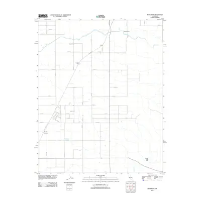
2012 Map of Richgrove
USGS Topo · Published 2012About this map
Agricultural development and irrigation networks define this portion of the San Joaquin Valley in Tulare County. The White River meanders across the northern reaches, while a rigid grid of avenues and roads, such as Avenue 44 and Richgrove Dr, organizes the landscape into productive ranching and farming plots. Local family-named holdings and rural junctions like Bartoldus Ranch, Nielson Ranch, and Orris illustrate the region's long-standing reliance on large-scale land management. Further south, the landscape transitions from the order of Vineyard Dr toward the more varied terrain of Locked Gate Gulch and the seasonal path of Five Dog Cr. The presence of specialized facilities like the White River Dairy and the Quality Ranch highlights the intensity of the local dairy and agricultural industries as they functioned in the early 21st century.
Find a feature on this map
44 named features on this map. Tap any name to fly to it.
Don’t see what you’re looking for? This feature index may not catch every label — zoom into the map to look around manually.
Map Details
Editions of this 2012 Richgrove Map
This is the sole edition of this map. No revisions or reprints were ever made.
Other maps of this area

1926 · Quincy School
USGS Topo · 1:31,680

1927 · McFarland
USGS Topo · 1:31,680

1929 · Delano
USGS Topo · 1:31,680

1929 · Sausalito School
USGS Topo · 1:31,680

1929 · Richgrove
USGS Topo · 1:31,680

1929 · Quincy School
USGS Topo · 1:31,680

1929 · Ducor
USGS Topo · 1:31,680

1930 · McFarland
USGS Topo · 1:31,680

1931 · Deepwell Ranch
USGS Topo · 1:31,680

1932 · Woody
USGS Topo · 1:62,500