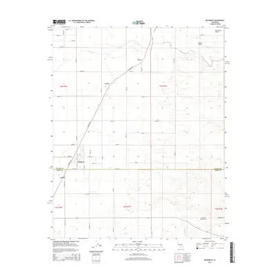
2015 Map of Richgrove
USGS Topo · Published 2015About this map
Richgrove and the surrounding agricultural landscapes of the Central Valley define this transition between the Southern Sierra foothills and the San Joaquin floor. Located along the Tulare and Kern County line, the area is characterized by a grid of citrus and vineyard access roads, including Grapefruit St and Quality Rd. These routes serve small community clusters like Orris, Vestal, and Quality. To the east, the terrain shifts into the rising folds of the foothills, where seasonal drainage is marked by White River, Five Dog Cr, and the descriptively named Locked Gate Gulch. This map provides a clear record of the modern irrigation and transportation infrastructure, such as Richgrove Dr, which supports the region's intensive fruit production.
Find a feature on this map
42 named features on this map. Tap any name to fly to it.
Don’t see what you’re looking for? This feature index may not catch every label — zoom into the map to look around manually.
Map Details
Editions of this 2015 Richgrove Map
This is the sole edition of this map. No revisions or reprints were ever made.
Other maps of this area

1926 · Quincy School
USGS Topo · 1:31,680

1927 · McFarland
USGS Topo · 1:31,680

1929 · Delano
USGS Topo · 1:31,680

1929 · Sausalito School
USGS Topo · 1:31,680

1929 · Richgrove
USGS Topo · 1:31,680

1929 · Quincy School
USGS Topo · 1:31,680

1929 · Ducor
USGS Topo · 1:31,680

1930 · McFarland
USGS Topo · 1:31,680

1931 · Deepwell Ranch
USGS Topo · 1:31,680

1932 · Woody
USGS Topo · 1:62,500