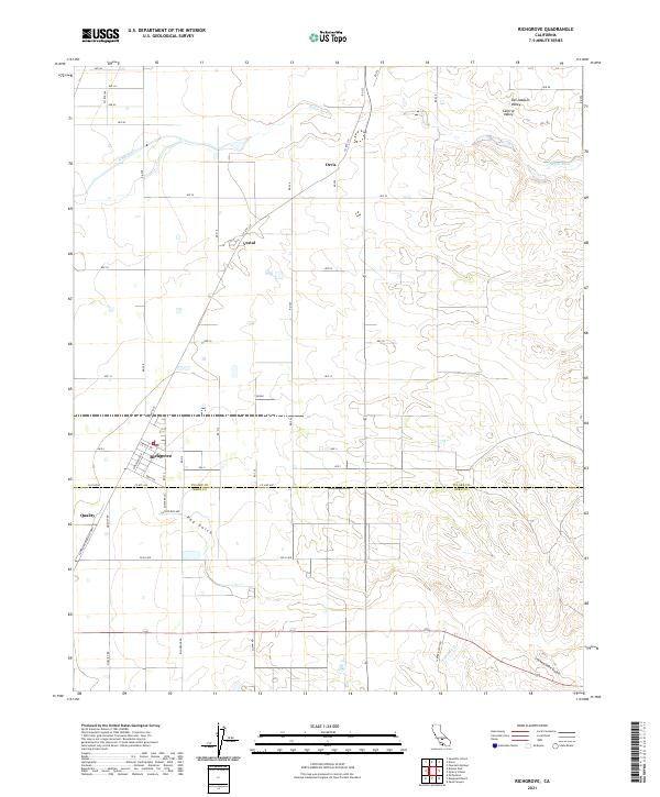
2021 Map of Richgrove
USGS Topo · Published 2021About this map
Richgrove sits at the intersection of Tulare and Kern counties, serving as a primary settlement within the agricultural expanse of the Central Valley. The landscape is defined by the precise grid of section lines and irrigation roads, including Ave 32 and Cecil Ave, which support the intensive farming characteristic of the San Joaquin Valley. Seasonal drainage patterns like White River and Rag Gulch cut through the terrain, illustrating the natural hydrology that predates the modern irrigation network. Smaller named locations such as Orris, Vestal, and Quality mark the historical nodes of local commerce and transit. To the southeast, the topography transitions into more complex drainages like Locked Gate Gulch and Five Dog Cr, where the flat valley floor begins to meet the rising foothills.
Find a feature on this map
53 named features on this map. Tap any name to fly to it.
Don’t see what you’re looking for? This feature index may not catch every label — zoom into the map to look around manually.
Map Details
Editions of this 2021 Richgrove Map
This is the sole edition of this map. No revisions or reprints were ever made.
Other maps of this area

1926 · Quincy School
USGS Topo · 1:31,680

1927 · McFarland
USGS Topo · 1:31,680

1929 · Delano
USGS Topo · 1:31,680

1929 · Sausalito School
USGS Topo · 1:31,680

1929 · Richgrove
USGS Topo · 1:31,680

1929 · Quincy School
USGS Topo · 1:31,680

1929 · Ducor
USGS Topo · 1:31,680

1930 · McFarland
USGS Topo · 1:31,680

1931 · Deepwell Ranch
USGS Topo · 1:31,680

1932 · Woody
USGS Topo · 1:62,500