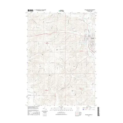
2016 Map of Richland Center
USGS Topo · Published 2016About this map
The Pine River winds through the driftless valley of Richland Center, carving a path through a landscape defined by prominent topographic features such as Chicken Ridge and Pauls Hill. This 2016 survey highlights the concentrated urban grid of the county seat, where the Richland Center Millpond serves as a central landmark near the river's bend. The surrounding countryside is dotted with small rural nodes like Basswood, connected by a network of winding roads including Co Hwy ZZ and Tuckaway Valley Rd.
Find a feature on this map
121 named features on this map. Tap any name to fly to it.
Don’t see what you’re looking for? This feature index may not catch every label — zoom into the map to look around manually.
Map Details
Editions of this 2016 Richland Center Map
This is the sole edition of this map. No revisions or reprints were ever made.
Other maps of this area

1905 · Richland Center
USGS Topo · 1:125,000

1933 · Boaz
USGS Topo · 1:62,500

1933 · Boscobel
USGS Topo · 1:62,500

1958 · La Crosse
USGS Topo · 1:250,000

1960 · Richland Center
USGS Topo · 1:62,500

1960 · Muscoda
USGS Topo · 1:62,500

1961 · La Crosse
USGS Topo · 1:250,000

1965 · La Crosse
USGS Topo · 1:250,000

1966 · Boaz
USGS Topo · 1:62,500
1967 · Boscobel
USGS Topo · 1:62,500