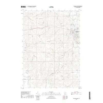
2018 Map of Richland Center
USGS Topo · Published 2018About this map
The Pine River meanders through the eastern edge of this landscape, defining the urban layout of Richland Center and its industrial corridors. This late-2010s survey illustrates a region characterized by deep valleys and prominent ridges, where agricultural roads like Dayton Ridge Rd and Tuckaway Valley Rd follow the natural contours of the land. The distribution of small rural cemeteries, including Dayton Corners Cem and Brown Cem, points to the long-standing family settlements that have anchored these ridges for generations.
Find a feature on this map
108 named features on this map. Tap any name to fly to it.
Don’t see what you’re looking for? This feature index may not catch every label — zoom into the map to look around manually.
Map Details
Editions of this 2018 Richland Center Map
This is the sole edition of this map. No revisions or reprints were ever made.
Other maps of this area

1905 · Richland Center
USGS Topo · 1:125,000

1933 · Boaz
USGS Topo · 1:62,500

1933 · Boscobel
USGS Topo · 1:62,500

1958 · La Crosse
USGS Topo · 1:250,000

1960 · Richland Center
USGS Topo · 1:62,500

1960 · Muscoda
USGS Topo · 1:62,500

1961 · La Crosse
USGS Topo · 1:250,000

1965 · La Crosse
USGS Topo · 1:250,000

1966 · Boaz
USGS Topo · 1:62,500
1967 · Boscobel
USGS Topo · 1:62,500