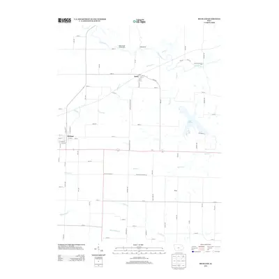
2013 Map of Richland
USGS Topo · Published 2013About this map
Richland serves as the primary hub for this southeastern Iowa landscape, where the grid of rural roads meets the meandering curves of the Skunk River. This 2013 survey reveals a territory defined by its waterways and conservation lands, notably the Rubio State Access Area and McKain State Access Area along the river banks. To the east, the waters of Lake Darling provide a significant recreational landmark amidst the agricultural fields. Smaller settlements like Rubio and Veo anchor the surrounding townships, connected by historic routes such as the Keokuk-Washington Road. The drainage patterns are intricate, with Richland Creek, Honey Creek, and several branches of Walnut Creek—including North Walnut Creek and Middle Walnut Creek—carving through the Keokuk and Washington county borderlands. This map is particularly useful for observing how the modern section-line road system navigates the irregular natural boundaries created by the river's floodplains and tributary valleys.
Find a feature on this map
76 named features on this map. Tap any name to fly to it.
Don’t see what you’re looking for? This feature index may not catch every label — zoom into the map to look around manually.
Map Details
Editions of this 2013 Richland Map
This is the sole edition of this map. No revisions or reprints were ever made.
Other maps of this area

1954 · Des Moines
USGS Topo · 1:250,000

1956 · Des Moines
USGS Topo · 1:250,000

1957 · Des Moines
USGS Topo · 1:250,000

1958 · Davenport
USGS Topo · 1:250,000

1961 · Davenport
USGS Topo · 1:250,000

1962 · Davenport
USGS Topo · 1:250,000

1965 · Harper
USGS Topo · 1:24,000

1969 · Des Moines
USGS Topo · 1:250,000
1973 · Keota
USGS Topo · 1:24,000

1973 · West Chester
USGS Topo · 1:24,000