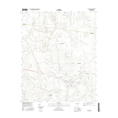
2016 Map of Richlands
USGS Topo · Published 2016About this map
Richlands serves as the primary hub of this coastal plain landscape, where the headwaters of the New River begin to take shape amidst a complex network of wetlands and small rural communities. The map reveals a transition from the dense, saturated environments of Hell Pocosin and Juniper Swamp to the cleared agricultural lands surrounding settlements like Huffmantown and Gregory Forks. The presence of numerous swamp systems, including Mill Swamp, Calhoun Swamp, and Jenkins Swamp, has historically dictated the placement of roads and homesteads, creating a pattern of development that follows the higher, drier ground between the drainages.
Find a feature on this map
75 named features on this map. Tap any name to fly to it.
Don’t see what you’re looking for? This feature index may not catch every label — zoom into the map to look around manually.
Map Details
Editions of this 2016 Richlands Map
This is the sole edition of this map. No revisions or reprints were ever made.
Other maps of this area

1903 · Trent River
USGS Topo · 1:62,500

1904 · Trent River
USGS Topo · 1:62,500

1943 · Jacksonville
USGS Topo · 1:62,500

1948 · Richlands
USGS Topo · 1:62,500

1953 · Rocky Mount
USGS Topo · 1:250,000

1953 · Beaufort
USGS Topo · 1:250,000

1954 · Rocky Mount
USGS Topo · 1:250,000

1954 · Beaufort
USGS Topo · 1:250,000

1958 · Deep Run
USGS Topo · 1:62,500

1965 · Richlands
USGS Topo · 1:62,500