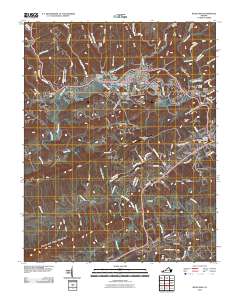
2010 Map of Richlands
USGS Topo · Published 2010About this map
Richlands serves as the central hub of this Appalachian landscape, situated along the Clinch River as the waterway winds through southwestern Virginia. The town’s layout is documented alongside its residential expansions like the Dalton Addition and local recreational spaces such as Lake Park. Industry and infrastructure are evident in the northern reaches where the Field-Scott Mines are located near Stone Cove Ridge, while the Tazewell County Airport sits on the high ground of Kents Ridge to the south. Numerous smaller communities such as Doran, Raven, and Cedar Bluff follow the river valley, connected by a network of state and local roads. For genealogists, the map identifies several significant interment sites, including the Clinch Valley Memorial Cemetery, Hankins Cemetery, and Green Hills Memorial Gardens, providing essential spatial context for family researchers. The southern portion of the quadrangle is defined by the massive profile of House And Barn Mountain and the course of the Little River.
Find a feature on this map
93 named features on this map. Tap any name to fly to it.
Don’t see what you’re looking for? This feature index may not catch every label — zoom into the map to look around manually.
Map Details
Editions of this 2010 Richlands Map
This is the sole edition of this map. No revisions or reprints were ever made.
Other maps of this area

1891 · Tazewell
USGS Topo · 1:125,000

1891 · Abingdon
USGS Topo · 1:125,000

1894 · Abingdon
USGS Topo · 1:125,000

1895 · Tazewell
USGS Topo · 1:125,000

1897 · Tazewell
USGS Topo · 1:125,000

1909 · Abingdon
USGS Topo · 1:96,000

1911 · Abingdon
USGS Topo · 1:125,000

1912 · Pounding Mill
USGS Topo · 1:62,500

1915 · Richlands
USGS Topo · 1:48,000

1916 · Pounding Mill
USGS Topo · 1:62,500