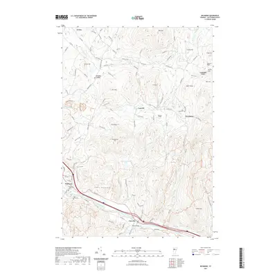
2021 Map of Richmond
USGS Topo · Published 2021About this map
The Winooski River carves a deep valley through the Green Mountains in this modern topographic study of Chittenden County. The settlement pattern follows this primary drainage, with Richmond and Jonesville anchored to the riverbanks while smaller outposts like Jericho Center and Nashville occupy the surrounding uplands. Local family history is preserved in a series of burial grounds including Richmond Village Cem, Saint Marys Cem, and the high-elevation West Bolton Cem. The landscape is dominated by significant peaks such as Stimson Mtn and Huckleberry Hill, which separate the river valley from northern drainage basins like the Lee River. Modern transit and recreational infrastructure, including the Mobbs Valley Mtb Trl and Meadow Airport, are superimposed on the traditional rural grid of roads like Browns Trace Rd.
Find a feature on this map
103 named features on this map. Tap any name to fly to it.
Don’t see what you’re looking for? This feature index may not catch every label — zoom into the map to look around manually.
Map Details
Editions of this 2021 Richmond Map
This is the sole edition of this map. No revisions or reprints were ever made.
Other maps of this area

1906 · Burlington
USGS Topo · 1:62,500

1913 · Milton
USGS Topo · 1:48,000

1915 · Milton
USGS Topo · 1:62,500

1919 · Burlington
USGS Topo · 1:62,500

1921 · Richmond
USGS Topo · 1:48,000

1924 · Camels Hump
USGS Topo · 1:62,500

1925 · Mount Mansfield
USGS Topo · 1:48,000

1927 · Mount Mansfield
USGS Topo · 1:62,500

1944 · Milton
USGS Topo · 1:62,500

1944 · Mount Mansfield
USGS Topo · 1:62,500