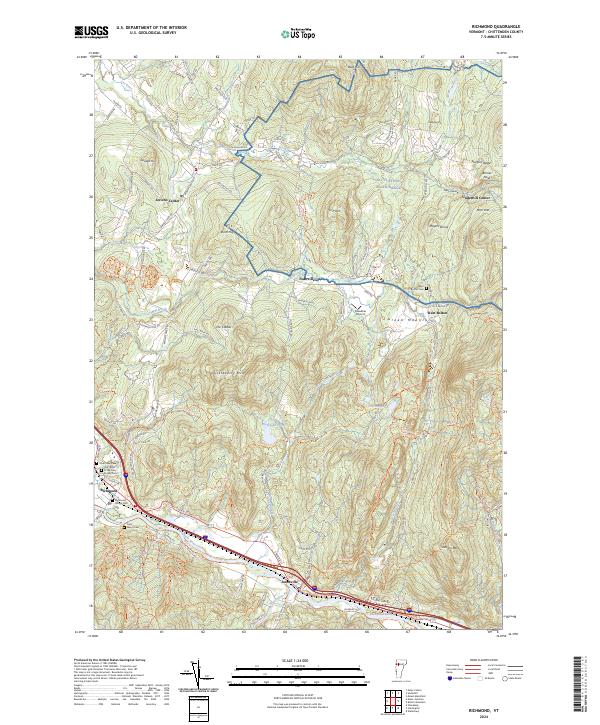
2024 Map of Richmond
USGS Topo · Published 2024About this map
The Winooski River and Huntington River define the southern lowlands of this Chittenden County landscape, where the settlements of Richmond and Jonesville anchor the valley. Further north, the terrain rises into the Green Mountains, characterized by prominent peaks like Birnies Nose and Stimson Mtn. This area is marked by a mix of historic rural village centers, including Jericho Center and Underhill Center, alongside more modern infrastructure like the Meadow Airport.
Find a feature on this map
76 named features on this map. Tap any name to fly to it.
Don’t see what you’re looking for? This feature index may not catch every label — zoom into the map to look around manually.
Map Details
Editions of this 2024 Richmond Map
This is the sole edition of this map. No revisions or reprints were ever made.
Other maps of this area

1906 · Burlington
USGS Topo · 1:62,500

1913 · Milton
USGS Topo · 1:48,000

1915 · Milton
USGS Topo · 1:62,500

1919 · Burlington
USGS Topo · 1:62,500

1921 · Richmond
USGS Topo · 1:48,000

1924 · Camels Hump
USGS Topo · 1:62,500

1925 · Mount Mansfield
USGS Topo · 1:48,000

1927 · Mount Mansfield
USGS Topo · 1:62,500

1944 · Milton
USGS Topo · 1:62,500

1944 · Mount Mansfield
USGS Topo · 1:62,500