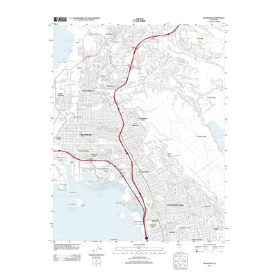
2012 Map of Richmond
USGS Topo · Published 2012About this map
The industrial and residential shoreline of Richmond and San Pablo is documented here as it appeared in the early 21st century. The map details a complex network of maritime infrastructure, from the Richmond Inner Harbor and Richmond Reserve Shipyard to the Lauritzen Canal. Extensive neighborhood developments such as Atchison Village, Nystrom Village, and University Village are shown alongside major institutional sites like the University of California Engineering Field Station. The eastern edge of the survey transitions into the high ridges of Sobrante Ridge and San Pablo Ridge, providing a contrast between the urbanized bay front and the protected lands around San Pablo Reservoir. Cultural landmarks, including the Golden Gate Fields racetrack near Fleming Point and the Saint Joseph Cem, anchor the map's geography, reflecting the area's long-established communities and commercial hubs.
Find a feature on this map
71 named features on this map. Tap any name to fly to it.
Don’t see what you’re looking for? This feature index may not catch every label — zoom into the map to look around manually.
Map Details
Editions of this 2012 Richmond Map
This is the sole edition of this map. No revisions or reprints were ever made.
Other maps of this area

1895 · San Francisco
USGS Topo · 1:62,500

1896 · Carquinez Strait
USGS Topo · 1:62,500

1897 · Concord
USGS Topo · 1:62,500

1898 · Karquines
USGS Topo · 1:62,500

1899 · San Francisco
USGS Topo · 1:62,500

1901 · Karquines
USGS Topo · 1:62,500

1902 · Napa
USGS Topo · 1:125,000

1915 · Concord
USGS Topo · 1:62,500

1915 · San Francisco
USGS Topo · 1:62,500

1916 · Mare Island
USGS Topo · 1:62,500