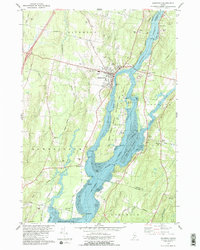
1980 Map of Richmond
USGS Topo · Published 1980About this map
The Kennebec River corridor defines this landscape, separating the settlements of Richmond and West Dresden while flowing into Merrymeeting Bay. The 1980 survey emphasizes the transition of Swan Island into the Steve Powell Wildlife Management Area, preserving a significant riparian habitat between the main channel and the Eastern River. Genealogists will find a wealth of family-named burial sites across the township, including Cotton Cem, Harwards Cem, and Evergreen Cem.
Find a feature on this map
79 named features on this map. Tap any name to fly to it.
Don’t see what you’re looking for? This feature index may not catch every label — zoom into the map to look around manually.
Map Details
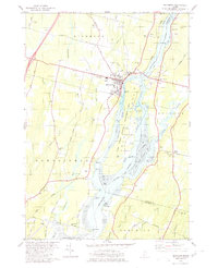
Editions of this 1980 Richmond Map
2 editions found
Other maps of this area

1892 · Gardiner
USGS Topo · 1:62,500

1893 · Wiscasset
USGS Topo · 1:62,500

1893 · Boothbay
USGS Topo · 1:62,500

1894 · Bath
USGS Topo · 1:62,500

1920 · Bath
USGS Topo · 1:62,500

1941 · Boothbay
USGS Topo · 1:62,500

1943 · Gardiner
USGS Topo · 1:62,500

1943 · Boothbay
USGS Topo · 1:62,500

1944 · Wiscasset
USGS Topo · 1:62,500

1944 · Boothbay
USGS Topo · 1:62,500