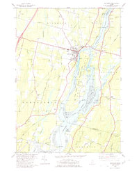
1980 Map of Richmond
USGS Topo · Published 1980About this map
The Kennebec River corridor dominates this 1980 survey, where the river widens near Swan Island before entering the expansive Merrymeeting Bay. The settlement of Richmond serves as a focal point along the western bank, flanked by the Maine Central Railroad and several historic family burial grounds including Evergreen Cem and Cotton Cem. Across the water, the Eastern River meanders through Dresden, passing West Dresden and the quiet crossroads of Hatchs Corner. The river's ecological and historical significance is highlighted by the Steve Powell Wildlife Management Area, which encompasses much of the island terrain between the main river channel and the smaller Little Swan Island. This map documents a landscape defined by its tidal flats and maritime points, from Southard Pt to the lower reaches of Chops Creek.
Find a feature on this map
82 named features on this map. Tap any name to fly to it.
Don’t see what you’re looking for? This feature index may not catch every label — zoom into the map to look around manually.
Map Details
Editions of this 1980 Richmond Map
2 editions found
Other maps of this area

1892 · Gardiner
USGS Topo · 1:62,500

1893 · Wiscasset
USGS Topo · 1:62,500

1893 · Boothbay
USGS Topo · 1:62,500

1894 · Bath
USGS Topo · 1:62,500

1920 · Bath
USGS Topo · 1:62,500

1941 · Boothbay
USGS Topo · 1:62,500

1943 · Gardiner
USGS Topo · 1:62,500

1943 · Boothbay
USGS Topo · 1:62,500

1944 · Wiscasset
USGS Topo · 1:62,500

1944 · Boothbay
USGS Topo · 1:62,500