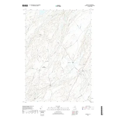
2019 Map of Richville
USGS Topo · Published 2019About this map
Richville and the winding Oswegatchie River define this North Country landscape in Saint Lawrence County. The river carves a complex path through the terrain, creating features like Snowshoe Island and the broad Spooner Flat, while several crossings such as Peabody Bridge and Rock Island Bridge connect the rural road network. The map reveals a high concentration of small cemeteries, including North Gouverneur Cem, Wayside Cem, and Maple Grove Cem, which are vital markers for local genealogical research.
Find a feature on this map
59 named features on this map. Tap any name to fly to it.
Don’t see what you’re looking for? This feature index may not catch every label — zoom into the map to look around manually.
Map Details
Editions of this 2019 Richville Map
This is the sole edition of this map. No revisions or reprints were ever made.
Other maps of this area

1904 · Ogdensburg
USGS Topo · 1:62,500

1905 · Ogdensburg
USGS Topo · 1:62,500

1906 · Brier Hill
USGS Topo · 1:62,500

1912 · Hammond
USGS Topo · 1:62,500

1915 · Gouverneur
USGS Topo · 1:62,500

1937 · Gouverneur
USGS Topo · 1:62,500

1943 · Rensselaer Falls
USGS Topo · 1:31,680

1943 · Edwardsville
USGS Topo · 1:31,680
1943 · Heuvelton
USGS Topo · 1:31,680

1944 · Hammond
USGS Topo · 1:62,500