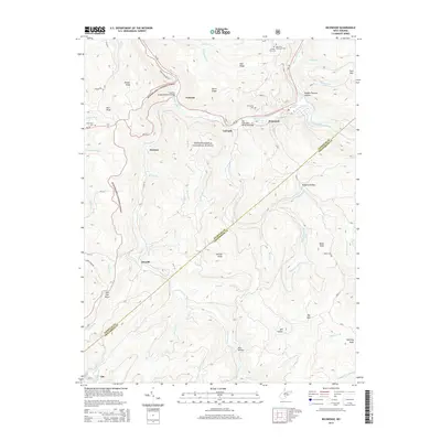
2014 Map of Richwood
USGS Topo · Published 2014About this map
The Cherry River serves as the central artery for this part of Nicholas County, where the town of Richwood is situated at the confluence of the North Fork Cherry River and South Fork Cherry River. This 2014 survey documents a landscape defined by sharp elevation changes within the Monongahela National Forest, reaching peaks like Big Mtn and Manning Knob. The settlement patterns follow the narrow river valleys and ridges, with smaller communities such as Fenwick, LaFrank, and Saxman clustered along the waterways and transportation routes like WV-39. Several hilltop cemeteries, including Hinkle Mtn Cem and Richwood Cem, provide vital points of interest for genealogists tracing family histories in the region. Notable infrastructure includes the Jim Comstock Memorial Bridge and the Bragg Memorial Bridge, spanning the deep drainages of the Allegheny Plateau.
Find a feature on this map
64 named features on this map. Tap any name to fly to it.
Don’t see what you’re looking for? This feature index may not catch every label — zoom into the map to look around manually.
Map Details
Editions of this 2014 Richwood Map
This is the sole edition of this map. No revisions or reprints were ever made.
Other maps of this area

1889 · Nicholas
USGS Topo · 1:125,000

1891 · Nicholas
USGS Topo · 1:125,000

1891 · Huntersville
USGS Topo · 1:125,000

1894 · Huntersville
USGS Topo · 1:125,000

1901 · Nicholas
USGS Topo · 1:125,000

1915 · Webster Springs
USGS Topo · 1:48,000

1915 · Cowen
USGS Topo · 1:48,000

1917 · Cowen
USGS Topo · 1:62,500

1918 · Webster Springs
USGS Topo · 1:62,500

1918 · Richwood
USGS Topo · 1:62,500