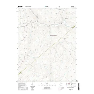
2016 Map of Richwood
USGS Topo · Published 2016About this map
Richwood serves as the primary hub in this mountainous region of Nicholas County, situated at the confluence where the North Fork Cherry River and South Fork Cherry River meet. The local infrastructure reflects a landscape shaped by narrow valleys and steep ridges, with the town connected to neighboring LaFrank and Fenwick by landmarks like the Jim Comstock Memorial Bridge and the Garrett Bragg Memorial Bridge. This 2016 survey documents the varied elevations of the Monongahela National Forest, reaching from the depths of Jets Hollow to the heights of Mann Knob and Fork Mtn. Genealogists will find several distinct burial sites across the terrain, including Richwood Cem, the Hinkle Mountain Cem, and the remote Baber Cem tucked near Baber Br. The settlement pattern follows the drainage of the Cherry River and its numerous tributaries like Laurel Creek and McMillion Cr, illustrating how development remains tied to the watercourses that carve through the high knobs.
Find a feature on this map
66 named features on this map. Tap any name to fly to it.
Don’t see what you’re looking for? This feature index may not catch every label — zoom into the map to look around manually.
Map Details
Editions of this 2016 Richwood Map
This is the sole edition of this map. No revisions or reprints were ever made.
Other maps of this area

1889 · Nicholas
USGS Topo · 1:125,000

1891 · Nicholas
USGS Topo · 1:125,000

1891 · Huntersville
USGS Topo · 1:125,000

1894 · Huntersville
USGS Topo · 1:125,000

1901 · Nicholas
USGS Topo · 1:125,000

1915 · Webster Springs
USGS Topo · 1:48,000

1915 · Cowen
USGS Topo · 1:48,000

1917 · Cowen
USGS Topo · 1:62,500

1918 · Webster Springs
USGS Topo · 1:62,500

1918 · Richwood
USGS Topo · 1:62,500